|
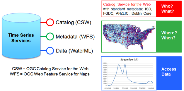
The Hydrologic Information System provides a service oriented architecture for publishing, cataloging, discovering and accessing hydrological data. The applied technology enables standardized publication of data and uniform access to distributed data repositories, allowing a national portrait of water resources at different spatial and temporal scales.
The HIS architecture originates from the pioneering works of CUAHSI and ESSI-Lab, together with the technical and scientific contribution of ARPA SIMC.
|
|
The CUAHSI Hydrologic Information System (HIS) is an internet based system for sharing water data. The system employs a service oriented architecture (SOA) that is similar to the way in which many federal government agencies transmit their data and has enabled an unprecendented access to a variety of data sources including the USGS, EPA, NCDC, in addition to academic researchers. The CUAHSI HIS was originally developed as a research project funded by the National Science Foundation and led by Principal Investigator Dr. David Maidment (Univeristy of Texas at Austin).
|
|
|
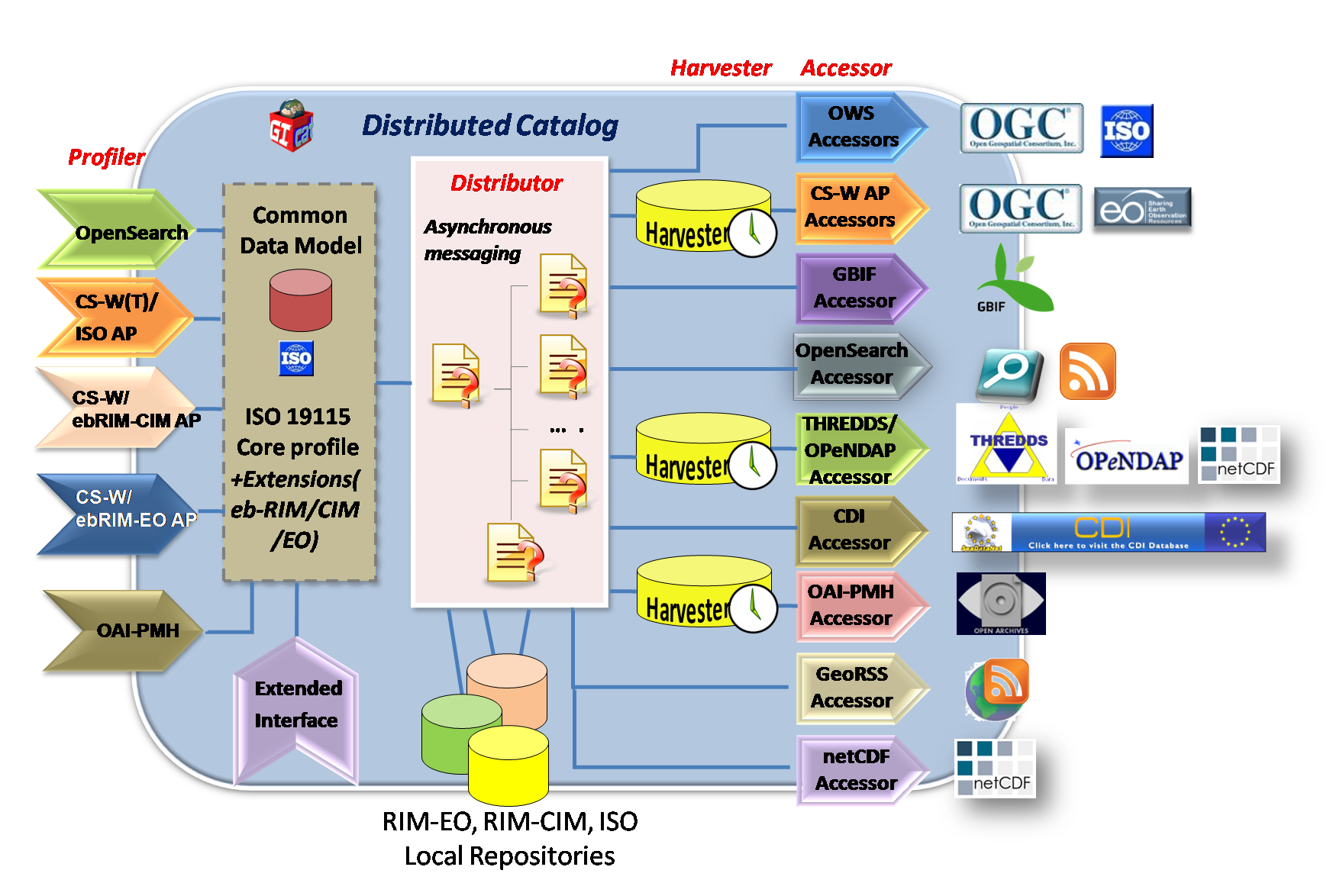
GI-cat is an implementation of a broker catalog service made by ESSI Lab: it can access a multiplicity of catalogs services, as well as inventory and access services to discover, and possibly access, heterogeneous ESS resources. Specific components implement mediation services for interfacing heterogeneous service providers which expose multiple standard specifications; they are called AccessorsGI-cat itself exposes several interfaces, including the OGC CSW interfaces (Core, ISO, ebRIM EO and ebRIM CIM). The query and result mediation is implemented by the Profilers. A Distributor component implements the query distribution functionalities (e.g. results aggregation).
|
|
ARPA SIMC developed the initial architecture of the Italian water data hub based upon the CUAHSI HIS and its application required appropriate code developments for a fully functional data management infrastructure. The original reliance on widely used commercial software was relaxed by offering alternative open source solutions, stimulating community code development and even wider diffusion of the offered technology.
These developments introduced a new architecture for water data sharing and this portal is an application of its technologies.
The primary benefits of data sharing is improved communications and understanding about water resource information, leading to better-informed policy decisions. As water availability and quality are crucial to so many sectors of society, maturing this information flow will also help advance research in many other geosciences areas.
|